Tokyo_Regional_View.jpg
Tokyo -- Regional View (from Google Earth)
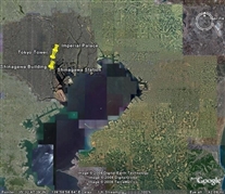
This item and the next one are views I downloaded off of Google Earth. These are aerial or satellite photos. I did this because their image of Shinagawa Station (next photo) was better than anything I was able to take while there (although, these "looking straight down" views seem a bit odd to me when they are of a place where I've seen it looking horizontally). I'm not very proficient with Google Earth, but I tried to add captions (push pins, in Google Earth terminology -- the objects are at the "point" of the "pin").
This is a regional view, showing Tokyo Bay, the city, and Narita Airport (the roughly diamond-shaped whitish blur under the word "Narita" at upper right).
(Tokyo_Regional_View.jpg)
