IMG_5247.jpg
Tokyo First Hotel 27 Oct 2007
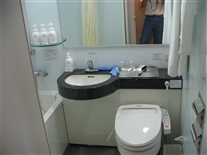
This photo shows part of the bathroom in my room at our first hotel in Tokyo (one train stop away from Shinagawa Station).
(IMG_5247.JPG)
IMG_5253.jpg
Tokyo First Hotel 27 Oct 2007
Tokyo 27 Oct 2007
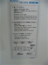
This photo shows the fascinating instructions for the tolilet in the hotel room (there were several sets of instructions posted in the bathroom for various pieces of equipment). The room also contained a device that is a combination teapot and humidifier (not shown). There was another item in the room (not shown) whose function I was never able to identify. Later, we ran into toilets even more complicated than the one shown in these two photos. In addition, we saw a few that were, well, primitive (I won't go into details on those).
(IMG_5253.JPG)
IMG_5266.jpg
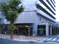
Tokyo Outside First Hotel 28 Oct 2007
Tokyo 28 Oct 2007
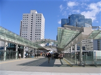
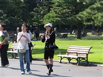
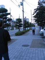
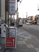
When John and I went out to look around outside the Tokyo hotel on Sunday (10-28-07), a street fair (sort of) was in progress on the walkway between the hotel and the train station. This photo and the next two were taken at that fair. John and I took advantage of this intial “jet lag recovery” day to see a bit of the city. We also tried to “find” the MHI building, where the first scheduled meeting we were involved in was to be held the next day. We were almost sucessful in this. Turns out Mitsubishii and Mitsubishi Heavy Industries (MHI) are two (essentially) separate companies – we were faked out because they each had a high-rise office building in the same complex, about 100 feet from one another. We initially “found” the wrong one.
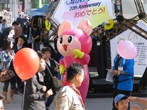
IMG_5269.jpg
Tokyo Outside First Hotel 28 Oct 2007
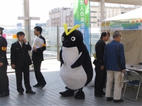
Part of the street fair. This character is apparently the logo from a company. I think I may have also seen it in the US.
(IMG_5269.JPG)
IMG_5271.jpg
Tokyo Outside First Hotel 28 Oct 2007
Note that the man in the foreground is a scoutmaster (one of his scouts is also in the photo). Also, notice how Japanese and English are mixed in the sign above the costumed character's head (this was common). I believe that particular type of Japanese script is called hiragana (or maybe hirakana) -- they have something like four types of "alphabets". I don’t recall the name of that first hotel in Tokyo, but it was new construction and was adjacent to an equally new office building called Thinkpark Tower, which was, in turn, adjacent to the Osaki (railroad) Station. I don’t think I was ever really on the Tokyo subway during this trip, only on Japan Rail. However, Japan Rail seems to operate just like a subway system inside the city.
It appeared the name Thinkpark Tower was always written in Engish – there did not appear to be an equivalent name in any of their other type of characters or scripts.
(IMG_5271.JPG)
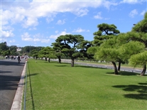
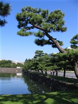
IMG_5275.jpg
Tokyo Public Gardens Near Imperial Palace 28 Oct 2007
This photo and the next three were taken in public gardens outside the imperial palace.
(IMG_5275.JPG)
IMG_5277.jpg
Tokyo Public Gardens Near Imperial Palace 28 Oct 2007
Enter image description for image
(IMG_5277.JPG)
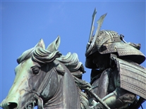
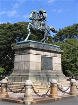
IMG_5279.jpg
Tokyo Public Gardens Near Imperial Palace 28 Oct 2007
We were there at the wrong time of day (wrong sun angle) to get a good photo of the statue's face, but it had detail similar to that of the horse and the helmet.
(IMG_5279.JPG)
IMG_5283.jpg
Tokyo Public Gardens Near Imperial Palace 28 Oct 2007
This photo is included to show how trendy younger people typically dress (the woman in the center of the photo -- with the white hat -- is typical of how the younger women dressed in the cities -- we saw LOTS of boots and miniskirts). I don't know exactly how to say this, but if I noticed how the women were dressed, their clothes must have been spectacular. I'm generally a typical nerd engineer with respect to noticing stuff like that.
(IMG_5283.JPG)
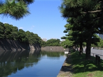
IMG_5284.jpg
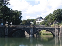
Tokyo Imperial Palace 28 Oct 2007
This photo and the next one are of a bridge over the moat at the palace. This is apparently the ceremonial entrance to the private portion of the palace grounds. The public area is at the right hand side of the bridge (as it appears in this photo) and the private area is at the left hand side.
We passed another entrance (more to the north), with a separate bridge across the moat, which looked like the entrance employees use.
(IMG_5284.JPG)
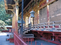
IMG_5285.jpg
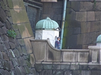
Tokyo Imperial Palace 28 Oct 2007
This picture is a close up (via zoom lens) of the ceremonial guard station on the bridge (they did a guard change ceremony while we were there).
(IMG_5285.JPG)
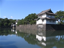
IMG_5292.jpg
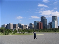
Tokyo Imperial Palace 28 Oct 2007
This photo was taken at about the same place as the previous two, but facing about 180 degrees around. The palace is VERY much in the center of the city.
(IMG_5292.JPG)
IMG_5294.jpg
Tokyo Imperial Palace 28 Oct 2007
This is the first of three photos taken at various points as we walked partway around the moat for the imperial palace. It appears the palace area used to be much larger. There are several other bodies of water in the area (not included in these photos) that APPEAR to be remnants of what used to be an outer moat (i.e., I suspect the current moat used to be innermost of two moats). Some of these are in the public gardens surrounding the current moat (the one in these photos) and some are in areas now mostly occupied by office buildings (the moat-like bodies of water are between office buildings). It’s also possible that what I took to be parts of an outer moat are actually remnants of canals that are no longer used.
(IMG_5294.JPG)
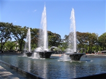
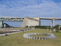
IMG_5306.jpg
Tokyo 28 Oct 2007
This photo and the next one were taken at a large fountain complex that we passed while walking between the imperial palace and Tokyo (train and subway) Station.
(IMG_5306.JPG)
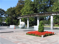
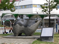
IMG_5309.jpg
Tokyo 28 Oct 2007
The roundish thing near the center of the photo is a sculpture that is apparently supposed to represent a rather idealized clamshell.
(IMG_5309.JPG)
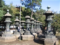
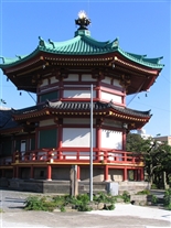
IMG_5335.jpg
Tokyo Ueno Park 28 Oct 2007
This photo was taken in Ueno Park in Tokyo (this is the first of 7 photos taken there).
The photo shows some of the very many very large lanterns in an area just outside a shrine (I THINK they are called lanterns, the word might be lamps).
(IMG_5335.JPG)
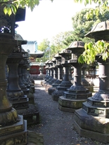
IMG_5322.jpg
Tokyo Ueno Park 28 Oct 2007
Another view of the lanterns. I'm guessing they were intended to burn some kind of oil (perhaps some type of fish or whale oil).
(IMG_5322.JPG)
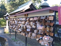
IMG_5323.jpg
Tokyo Ueno Park 28 Oct 2007
These are prayer plaques called (I believe) ema (this is right outside a shrine). Some prayers were written in English and other non-asian languages
(IMG_5323.JPG)
IMG_5333.jpg
Tokyo Ueno Park 28 Oct 2007
This photo shows a portion of the exterior of the shrine itself (we went inside, but couldn't take photos there). Notice the fire extinguisher at the right-hand side of the photo (the shrine is essentially 100% very old wood).
(IMG_5333.JPG)
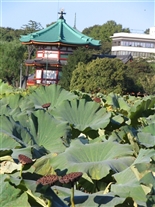
IMG_5359.jpg
Tokyo Ueno Park 28 Oct 2007
The pagoda-type building in the photo is really vertical, it was my camera (or perhaps me) that was a bit crooked (this WAS the jet lag recovery day). This is taken looking across a pond that is filled with a type of floating or water-based vegetation. I think I later read this pond is known for containing lotus. I suspect we were there too late in the season to see lotus blossoms. The interesting cookie-shaped things on stems appear to be some kind of seedpod. Perhaps it develops later in the season, after the plant is no longer producing blossoms.
(IMG_5359.JPG)
IMG_5347.jpg
Tokyo Ueno Park 28 Oct 2007
In Ueno Park I saw a cat (apparently feral) with no tail. Thought it had been in an accident and felt sorry for it. Then, about 30 minutes later, I saw a SECOND cat with no tail. I later learned there is a breed (species?) of cat native to Japan that are born without tails.
(IMG_5347.JPG)
IMG_5364.jpg
Kobe 4 Nov 2007
This is the first of about nine photos all taken early (before breakfast) on Sunday, Nov 4 in Kobe (Hyogo district), during a "free" morning, before we left via shinkansen (bullet train) for Tokyo that afternoon.
This is the entrance to the hotel we stayed at during the first time in Kobe.
I learned later that Hyogo (which includes the original sea port) is historically the oldest portion of the city. However, little, if anything, in these photos is more than about 60 years old. The Hyogo district was especially (intentionally) hard hit in the raid on Kobe by US B-29s on March 17, 1945. In addition, Kobe was extensively damaged by a January 17, 1995 earthquake (4600 deaths within the city). I don't know how much this particular area had to be rebuilt after the earthquake.
Notice that no photos in this album correspond to the days between October 28 and November 4. We really did work long hours most days over there.
(IMG_5364.JPG)
IMG_5368.jpg
Kobe 4 Nov 2007
This photo was taken within about 75 ft of the entrance to the hotel we stayed at during the first time in Kobe.
(IMG_5368.JPG)
IMG_5383.jpg
Kobe 4 Nov 2007
This photo was taken at a shrine 5 or 6 blocks away from the hotel. The next two photos were also taken at that shrine.
Dennis Gerh is in this photo.
(IMG_5383.JPG)
IMG_5388.jpg
Kobe 4 Nov 2007
Primary reason for taking this photo was the trees. This entire street was lined with trees like that. Not sure if they were sculpted in some way or if they just grow like that
Gary is on left hand side, Dennis is in center.
(IMG_5388.jpg)
IMG_5389.jpg
Kobe 4 Nov 2007
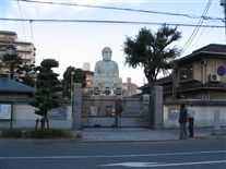
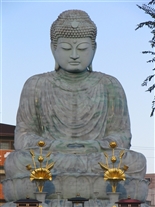
Dennis is in this photo, along with the person we had asked for directions to this Buddha. We had expected the "large Buddha" we had heard about to be perhaps 10-12 feet tall, and were looking for something that size. It turned out to be SO large, that we almost missed it.
(IMG_5389.JPG)
IMG_5393.jpg
Kobe 4 Nov 2007
The type of Japanese script in this photo is called kanji. Kanji are not phonetic (hiragana, shown in an earlier photo, are phonetic -- I believe each symbol in it is a syllable). Most proper names (like the names of people) are written in kanji. The kanji are based on Chinese characters. However (as I understand it), the two written languages have evolved separately over time (the hundreds of years since the Chinese writing was introduced into Japan), so now a specific kanji is often somewhat different from the corresponding Chinese character it was originally based on (I think the Chinese name for these characters may be something like hanji).
(IMG_5393.JPG)
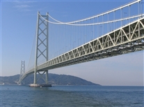
IMG_5421.jpg
Kobe Tarumi District 4 Nov 2007
This photo was taken in the Tarumi district of Kobe (west of the central areas of the city). The Akashi-Kaikyo Bridge is said to be the longest suspension bridge in the world. It goes from Maiko, (a neighborhood?) in the Tarumi district, to Awaji Island, a large island in the Inland Sea (which, despite its name, IS connected to the Pacific Ocean -- I suspect it is, more properly, a sound).
We went to the bridge by train. Maiko is perhaps 8 stops from the Hyogo Station, which was, in turn, about a block from the first Kobe hotel. The Japanese rail and subway maps are pretty much schematic diagrams, better for telling the sequence of stations than for showing distance -- or for showing where the station is, relative to stuff around it not associated with the railroad. Based on the map, it LOOKED like the Maiko Station was the closest one to this bridge, so we bought tickets to Maiko. Turned out the Maiko Station was directly under the approach ramps at the north end of the bridge. (There were other times when we had considerably less success with trains and subways.)
(IMG_5421.jpg)
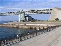
IMG_5427.jpg
Kobe Tarumi District 4 Nov 2007
Stuff here is described in conjunction with previous photo and next photo. This was just such a beautiful day that I couldn't resist adding one more photo when I converted this set from the Facebook version to the web site version.
(IMG_5427.JPG)
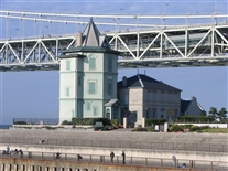
IMG_5429.jpg
Kobe Tarumi District 4 Nov 2007
This photo shows an outdoor sculpture near the bridge (one of several sculptures, if I recall correctly). The building at the left-hand edge of this photo is the Sun Yat-Sen Cultural Center. Sun Yat-Sen was the first president of the Republic of China (post-imperial China), who took office around 1911-1912. I never found out why this building in Japan was named after a Chinese leader.
(IMG_5429.JPG)
IMG_5432.jpg
Kobe Tarumi District 4 Nov 2007
Temple (described in conjuncition with next photo. Note the raked sand garden on the left hand side of the photo.
(IMG_5432.JPG)
IMG_5438.jpg
Kobe Tarumi District 4 Nov 2007
This photo was taken at a Buddhist temple (I think it's called a temple) in Maiko, near the suspension bridge featured in previous photos. If I understand things correctly, in the Japanese religion(s) Buddha is mostly concerned with the dead and Shinto is mostly concerned with the living. The gray stone slabs in the foreground are memorial markers (like grave markers), and I suspect the light-colored ones up on the mound in the background are too. I later learned that these probably do not mark below-grade "graves," in the sense that I think of them in the US. In Japan, as I understand it, the dead are generally cremated. These markers contain a compartment that holds the ashes. That's one reason they can be so closely spaced.
(IMG_5438.JPG)
IMG_5441.jpg
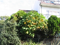
Kobe Tarumi District 4 Nov 2007
This photo shows an interesting flowering tree that we passed in Maiko. I don't know the name of the type of tree, but it seemed remarkable to see a flowering tree at the time of year we were there.
(IMG_5441.JPG)
IMG_5442.jpg
Kobe Tarumi District 4 Nov 2007
Close up of the flowers hanging from the tree.
(IMG_5442.JPG)
IMG_5456.jpg
Kobe 4 Nov 2007
This photo is the statue of a bull (or cow) near the train station in the Hyogo district (near the first Kobe hotel). Kobe is famous for its steaks (which we were able to have on one night on this trip). {I later heard that a few years ago NASA was looking to purchase a used Boeing 747 cargo plane to be used (after modifications) as a "flying platform" for some type of telescope (for ultraviolet observations, I suppose). At that time (and perhaps still), it was economical to fly live cattle from the US to Japan. The NASA request for proposals explicitly stated they would not accept a plane that had ever been used for such a "beef run" (I suspect they were concerned about getting the cargo space sufficiently clean to prevent volatiles from interfering with the astronomical observations).}
(IMG_5456.JPG)
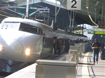
IMG_5462.jpg
Kobe Shin-Kobe Station 4 Nov 2007
Shin-Kobe station means "New" Kobe station, I think -- they apparently had no way to get the shinkansen (what is often called their "bullet train: in the US) into the heart of Kobe, so they built a special station for them north of the main downtown area.
The photo shows a train (not ours) that discharged and loaded passengers while we were waiting for the express train taking us to Tokyo (I presume this particular train was a "local" that made more stops than ours, or perhaps it did not go all the way to Tokyo). These trains spend perhaps only 2-3 minutes at each stop, so you have to be "ready" when "your" train comes (or, if on the train, when it comes to "your" destination).
The rectangular structure in the bottom center of this photo is part of the automatic gate structure that is built into the platform. The reserved seat tickets are for a specific seat in a specific car on the train (say, Car #6). There are signs on the platform stating where the entrances to Car #6 will be when the train arrives -- and you wait there. Every train that I took stopped so that the car's entrances were within perhaps 3 inches of that marked spot. (We first saw this in the train leaving the Narita Airport near Tokyo, which was not a shinkansen -- but it was a fairly new train line.) I don't remember subways and the local in-town trains in Tokyo lining up quite so precisely.)
Gary is on the right-hand side of this photo, looking down at his camera.
(IMG_5462.JPG)
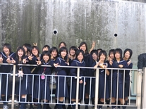
IMG_5468.jpg
Kobe Shin-Kobe Station 4 Nov 2007
This photo shows a group of girls on the platform opposite ours (they were waiting for a shinkansen going away from Tokyo – roughly toward Hiroshima, if I remember the geography correctly). We saw children in school uniforms like this on a few occasions (it is, perhaps, a factor that contributes to them adopting the trendy clothes -- seen in an earlier photo -- once they get out of school). We also saw the two-finger hand signal visible in this photo on a few other occasions. I'm not sure what it means. It SEEMED friendly, but I'm not certain.
Obviously the platform is level, not sloping uphill as it appears here. I was the camera that was "unlevel". Probably should have edited this photo to level out that platforrm.
(IMG_5468.JPG)
IMG_5479.jpg
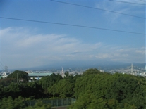
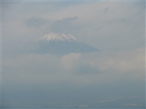
Mount Fuji 4 Nov 2007 (taken from shinkansen between Osaka and Tokyo)
This was taken with the zoom lens full out.
I didn't get any good photos of the inside of the train. One interesting thing was that when the conductors came to collect tickets, they would start at the front of the car and bow to the passengers (a male conductor would remove his hat during the bow). If they were going thru the train from back to front, they would still go to the front of the car and bow before going to individual seats to take tickets. The people with carts selling food and drinks would also bow when they entered a car.
(IMG_5479.JPG)
IMG_5480.jpg
Mount Fuji 4 Nov 2007 (taken from shinkansen between Osaka and Tokyo)
This was taken with the zoom lens full out.
I didn't get any good photos of the inside of the train. One interesting thing was that when the conductors came to collect tickets, they would start at the front of the car and bow to the passengers (a male conductor would remove his hat during the bow). If they were going thru the train from back to front, they would still go to the front of the car and bow before going to individual seats to take tickets. The people with carts selling food and drinks would also bow when they entered a car.
(IMG_5480.JPG)
IMG_5480A.jpg
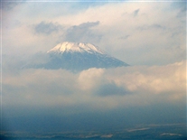
Mount Fuji 4 Nov 2007 (taken from shinkansen between Osaka and Tokyo)
This is an alternative version of the previous photo. I used my Microsoft photo editor program to "correct" color, exposer, contrast, etc., to try to remove some of the haze. I used several "automatic" options in the program.
This photo was not in the original e-mails or the Facebook album. The edits were made in February 2014 for the version of this album intended for the web site version of the album.
(IMG_5480A.JPG)
IMG_5481.jpg
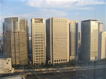
Shinagawa District Tokyo 4 Nov 2007
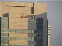
This photo is a view of the Mitsubishi Heavy Industries (MHI) building in the Shinagawa district in Tokyo (the next photo is the same, but with a zoom lens). Both of these photos were taken from my room on the 30th floor (I think that's the floor we were on -- it was pretty high up) of one of the towers of the Prince Hotel, on the opposite side of Shinagawa Station from the MHI building. This hotel had several towers -- at least two of them high rises. Part of Shinagawa Station is near the bottom of this photograph. Most of the photos I took from this hotel room did not turn out especially well, partly because of the reflections off the glass. One of the other buildings in this photo is a Mitsubishi Corporation office building. As mentioned above, John and I learned (the hard way) that Mitsubishi and MHI are not the same thing.
There is an Outback Steakhouse near the MHI building in this complex (we were ready to try "American" food at that point -- although I thought the Japanese food was excellent). Surprisingly (to me), the Outback did not have Australian beer. This was a good thing, however; otherwise I probably would not have tried Asahi (beer), which (I learned) is outstanding (at least the on-draft version is).
I apparently never got a picture of the vending machines on each floor of most of the hotels we stayed at -- they sold cans of beer in addition to cans of soft drinks. I never used any of those machines.
I also did not get a photo of a beer-dispensing machine in the business class lounge at the Osaka airport. It filled a glass using a moving spout-dispenser that was apparently designed to limit the amount of foam in the glass (the spout moved up so it was always about 0.5 inch above the level of the liquid as the glass was filled). There was another American in the lounge watching this machine with me. He said, "Only in Japan."
(IMG_5481.JPG)
IMG_5483.jpg
Shinagawa District Tokyo 4 Nov 2007
Close up of the top of the MHI building.(taken with zoom lens).
(IMG_5483.JPG)
IMG_5485.jpg
Shinagawa District Tokyo 4 Nov 2007
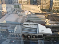
This was taken from the hotel room, looking almost straight down at the station. I saw this as at least three connected stations: (1) regular trains; (2) shinkansen; and (3) city subway system.
(IMG_5485.JPG)
IMG_5488.jpg
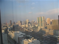
Shinagawa District Tokyo 4 Nov 2007
This is the view to the north from my hotel room. The Tokyo Tower is on the left hand side (with the sort of "barber pole" paint job). A few of the tracks and platforms on the north side of Shinagawa Station are visible on the lower right hand side of the photo. Not a good photo because of reflections off the glass. View from this hotel room was quite spectacular at night too, but I didn't think to try to photograph that.
This was a VERY expensive hotel (AND we seemed to have premium corner rooms). However, I suspect MHI (who made the reservations) got a special rate for us, since it didn't seem THAT expensive given how weak the dollar was -- and that this was Tokyo. MHI probably books a lot of people in this hotel, since it is so close to this office, so they may have access to a special business room-rate.
(IMG_5488.JPG)
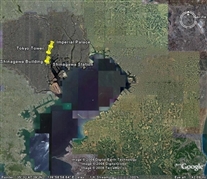
Tokyo_Regional_View.jpg
Tokyo -- Regional View (from Google Earth)
This item and the next one are views I downloaded off of Google Earth. These are aerial or satellite photos. I did this because their image of Shinagawa Station (next photo) was better than anything I was able to take while there (although, these "looking straight down" views seem a bit odd to me when they are of a place where I've seen it looking horizontally). I'm not very proficient with Google Earth, but I tried to add captions (push pins, in Google Earth terminology -- the objects are at the "point" of the "pin").
This is a regional view, showing Tokyo Bay, the city, and Narita Airport (the roughly diamond-shaped whitish blur under the word "Narita" at upper right).
(Tokyo_Regional_View.jpg)
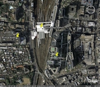
Shinagawa_Station_Area.jpg
Tokyo -- Shinagaws Station (from Google Earth)
This image focuses on Shinagawa Station. The linear features above (north of) and below (south of) the train station are tracks and platforms. The shinkansen uses the rightmost (most eastern) tracks -- the loading platform for the shinkansen seemed to be the only platform that was enclosed.
The Prince Hotel "pin" points at the tower we stayed in. For scale, the Price Hotel tower and the MHI building are about 0.3 miles apart (crow flight). We had to go between them by walking thru Shinagawa Station, which was probably at least double that distance. We walked thru at rush hour, when the station was quite crowded (with people getting off of trains or going toward the entrances to the train area, in addition to people like us using it as a bridge across the rail tracks). Walking thru the station was like moving thru a river of men (and some women) -- all wearing black suits.
If you want to look at this area with Google Earth or one of the satelite map web sites (more useful -- and more fun -- than this "captured" image), Shinagawa Station is at about 35 deg, 39 min North and 139 deg, 44 min, 20 sec East.
The hotel where John and I stayed the first time in Tokyo is near Osaki Station, perhaps 2 miles southwest of Shinagawa Station (it is at about 35 deg, 37 min, 12 sec North and 139 deg, 43 min, 40 sec East). When I looked at that area using Google Earth around early 2009, it looked to me like the satellite photo they have for that area was taken when that hotel and the adjacent Thinkpark Tower were still under construction.
(Shinagawa_Station_Area.jpg)
IMG_5495.jpg
Shinagawa District Tokyo 4 Nov 2007
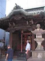
This is a small shire we passed between the hotel and Shinagawa Statiopn.
(IMG_5495.JPG)
IMG_5517.jpg
Kobe Probably 9 Nov 2007
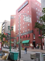
This is the hotel I stayed at during my second trip to Kobe.
(IMG_5517.JPG)
IMG_5520.jpg
Kobe 9 Nov 2007
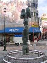
Taken in early morning, as I was going to the rail station to go to Kyoto.
This photo shows a sculpture on the street near the hotel I stayed at during my second stay in Kobe. Note the variety of scripts (characters) in the signs in the background.
This hotel was near Sannamiya Station. This is a rail/subway station that is gigantic (there is a shopping mall inside it). However, most of it is underground, so I don't think there is any way to photograph it. This neighborhood also appeared to be the center of night life in Kobe. As you can see from this photo, it was VERY quiet in the morning. The difference between night and day there was like the difference between -- well -- night and day.
(IMG_5520.JPG)
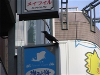
IMG_5514.jpg
Kobe Probably 9 Nov 2007
Large black bird (a raven?) on a very urban city street. It has been VERY close to me, but moved away while I was getting my camera out.
(IMG_5514.JPG)
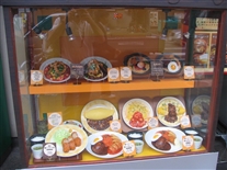
IMG_5516.jpg
Kobe 9 Nov 2007
This photo is a plastic food display in the front window of a restaurant. These are very common (and very useful for someone like me, who doesn't speak Japanese -- I think the Japanese word for the Japanese language is Nihongo). I suspect making these plastic models of food is a big industry there -- one that we don't have here. There were also photos of prepared dishes on menus in many instances – also very helpful.
(IMG_5516.JPG)
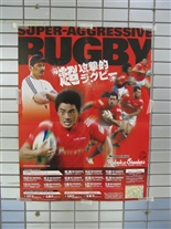
IMG_5505.jpg
Kobe Probably 8 Nov 2007
This photo shows a poster on the wall of a Kobe subway station. This poster is for Kobe's professional (rugby) football team, the Steelers. It is named for much the same reason as the Pittsburgh Steelers -- Kobe was the historical center of Japan's steel industry. The team name is near the right-hand side of the poster, about 2/3 of the way down.
This photo was taken after my second train trip to Kobe (I think -- it's starting to get fuzzy in my memory, and with those long hours, some of this trip was probably fuzzy from the get go).
You might notice there are no photos of the MHI building in Kobe -- the building where the nuclear reactor design/analysis people who are sited there work. It was in a shipyard (where I couldn't take a camera -- or at least I didn't feel comfortable taking one onto a customer's property). Also, it was some distance from the entrance of the shipyard to that particular office building, so I wouldn't have been able to stand outside the gate photograph the building. Apparently the shipyard was one of MHI's original businesses in Kobe. As they added product lines, they built facilites for their other businesses on this land they already owned.
The office workers in the "nuclear" building in Kobe dressed somewhat differently at work than those in the MHI offices in Tokyo. At the shipyard, they generally wore the same types of powder blue uniforms that the shipyard workers wore (even the nuclear vice president wore a uniform). They seemed to have change rooms, where they put on these uniforms after arriving at work in the morning -- we didn't' seen anyone in uniform on the Kobe subway trains when traveling to or from the shipyard. (In Tokyo, they all wore black business suits. I noticed one of the waitresses at the company dining room in Tokyo coming into the building in a black business suit. She apparently changed into her waitress uniform after reporing to work.)
There was a little museum or visitor center in the building in Kobe. It had displays of various MHI products (including an interesting robot who would move in response to voice commands -- IF you spoke to it in Japanese). This visitor center also had a large photo on one wall showing what the shipyard looked like in October 1945 -- basically a flat wasteland after the bombings. I think this visitor center was intended primarily for business visitors (such as potential customers), not for the general public.
The MHI engineers and managers we met with impressed me greatly. Part of what we did in these meetings was to go over the documents that WSMS had prepared (in English) sentence-by-sentence. I was amazed that, at several points, the MHI people were able to pick up statements that could potentially be misinterpreted (or that did not accurately describe the analyses that had been performed). In a few instances, they also pointed out some awkward English grammar. It was amazing to me that they could do this in (what was, to them) a foreign language. Also, after meeting with us, some of them stayed late to do their "real" jobs (some of their analyses to support the US NRC license application was still in progress when we were there). And, especially in Tokyo, where housing in the city is SO expensive in the city, the long work days of some of the younger workers were extended by commuting times by train of more than an hour, each way (the only housing they could afford was very far outside the city). Again, I was quite impressed.
One night, while waiting for a train at the subway station near the shipyard in Kobe, Dennis, Gary, and I spoke to an American teacher who has lived in Kobe for 2-3 years. He has a contract to teach English to MHI employees at after-work-hours classes in the MHI facility. He said his students (some of whom were probably in our meetings) are VERY smart (no surprise to us at that point).
(IMG_5505.JPG)
IMG_5527.jpg
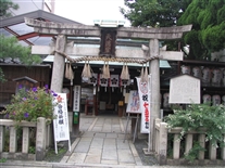
Kyoto 9 Nov 2007
The last business meeting I was involved in on the trip ended late on November 8, and my return flight was scheduled for November 10. Thus I had November 9 as a mostly free day (I did have a few follow-up and "lookup" items to take care of at the hotel). All of the remaining photos were taken on Friday, November 9.
The MHI people recommended going to see Kyoto (about 25 minutes from Kobe on the shinkansen) during that free day. Using the internet, I found out there was a 5-hour English-language guided walking tour there every Monday, Wednesday, and Friday, starting at the rail station. So I went to Kyoto and joined that tour.
Kyoto is a fairly large city. There are several -- perhaps 20 or 30 -- historic temples and shrines (and the old imperial palace) -- and they are fairly spread out. The walking tour basically limits one to stuff within a mile or so of the train station -- but there was a LOT to see within that distance. They have a subway system (which I did not use), but apparently some shrines (etc.) are not conveniently served by subway stations. Looked like a lot of the touring is done by charter buses -- but I'm not sure any of them have English narrations. Also, I saw on the internet that bicycle rentals are available, which (in good weather -- and with a map and guidebook) might be the best compromise (but I have few complaints about my walking tour).
It surprised me (but shouldn't have) that only about 1/3 of the 35 or so people on the English-language walking tour were from North America. There were perhaps another 1/3 from Britain, Australia, and New Zealand. The other (roughly) 1/3 were from places like Germany, Norway, and Singapore. I suspect some of these people were not able to get a narrated tour in their native language, so they went for a narrated tour in their second or third language.
My knowledge of Japanese history is pretty much limited to seeing a couple episodes of the "Shogun" TV miniseries several years ago. However, my understanding is that Kyoto is considered the historic capitol because for a few hundred years (up until the 1860s) the emperor lived there. For most of that time, the emperor was pretty much a figurehead, and the shogun (a military leader, who lived in Tokyo) really ran the country (Tokyo may have been known as Edo for some of that era). In the 1860s, a powerful emperor overthrew the shogun and moved the capitol to Tokyo. The current imperial palace in Tokyo is at the site of what had been the shogun's palace.
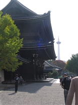
This photo shows the gate house of a large Buddhist temple (I'm pretty sure it was buddhist). The main building was being repaired and was covered with scaffolding that had sort of curtains on it -- making it look a bit like a large tent). Thus I didn't get any good photos of the main building (which was said to be the largest wooden building in the world). We did go through a small portion of that main building, that was not directly affected by the ongoing work.
(IMG_5527.JPG)
IMG_5539.jpg
Kyoto 9 Nov 2007
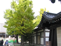
This is from inside the grounds of the temple. The thing in the distance is Kyoto Tower, which is across the street from the (quite modern-looking) rail station.
It did not occur to me until several days later that the Kyoto Tower is probably designed to provide an overview "tour" of the city, and I could have gone to the top of it (for an admission fee, of course). The historic portion of Kyoto appears to be in a north-south-running flat-bottomed river valley, with north-south-running ridges to the east and west. I suspect the terrain is such that most of the temples and shrines (some of which are on the ridges) are visible from that tower. (The tower and rail station seemed to be near the south end of the historic district.)
Some trees were turning while we were there. The one on the left-hand side of this photo was an especially nice color. However, the sun angle in this particular photo doesn't really bring out that color.
(IMG_5539.JPG)
IMG_5540.jpg
Kyoto 9 Nov 2007
This is here because of the color of the tree. Could not find a way to get both a sun angle that showed off a tree and another interesting object in the same photo.
(IMG_5540.JPG)
IMG_5530.jpg
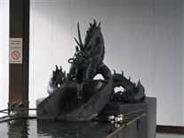
Kyoto 9 Nov 2007
This photo shows a sculpture of a dragon "protecting" a water trough on the grounds of the temple (we'd seen similar things at other places, but this dragon seemed especially ferocious).
(IMG_5530.JPG)
IMG_5544.jpg
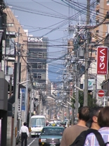
Kyoto 9 Nov 2007
This photo is (like the bridge photo that appears earlier) an engineer-tourist thing. We saw overhead utilities in every city, but they seemed most extreme in Kyoto. This photo really isn't typical of Kyoto -- this is the most cable dense of several locations that I photographed there (and there is somewhat of a telephoto effect). I wondered if the fact that Kyoto was never hit with a B-29 raid might have contributed to the large number of overhead wires -- Kyoto did not have the forced post- WWII "urban renewal" that most of the other cities had. The guide said that the city had burned several times (most recently in the 1880s, if I remember correctly). Thus when they say something (e.g., a shrine) is 800 years old, they mean that a shrine has existed at that location for 800 years. The actual structure there now is much younger -- and may be 5th or 6th structure that has been at the site.
One stop in the town (photo omitted) was at a factory/shop where the make (and sell) expensive hand-painted fans. The guide said this used to be a significant industry in Kyoto, but it is declining due to imports of cheap "tourist grade" fans from China. No one said anything to him, but I was not the only American on this tour who recognized some irony in this.
(IMG_5544.JPG)
IMG_5563.jpg
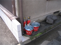
Kyoto 9 Nov 2007
The guide told us that, although several shirnes and temples have been in Kyoto for hundreds of years, as instituitions, very few actual buildings in the city are older than 200-300 years old because of periodic large fires (the most recent in 1885, I believe). He said we would see fire extinuishers and buckets all over time -- there are required by city ordinances. This photo shows one set of buckets that I noticed.
(IMG_5563.JPG)
IMG_5548.jpg
Kyoto 9 Nov 2007
Appearently Shinto shirnes "specialize" in various human/social attributes. I believe the guide said this is one where one prays for wisdom.
(IMG_5548.JPG)
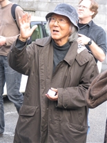
IMG_5575.jpg
Kyoto 9 Nov 2007
This photo shows the guide of the walking tour. I'm guessing he was in his early 70s. I tried to estimate what he made from doing tours like this 3 days per week (by counting the number of people on this tour and knowing what he charged). I'm pretty sure he does quite well.
(IMG_5575.JPG)
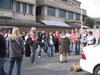
IMG_5573.jpg
Kyoto 9 Nov 2007
This photo shows the walking-tour guide (facing away) and some of the others on the tour group. The building in the back is the art deco former headquarters of the Nintendo Company, built in the 1930s. Nintendo still owns the building, but it is no longer their main office.
(IMG_5573.JPG)
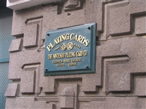
IMG_5579.jpg
Kyoto 9 Nov 2007
This photo and the next one are the signs on each side of the main entrance to the Nintendo building (apparently unchanged from when the building was constructed). While Sony was originally an electronics company that worked its way into games, Nintendo started as a games company and worked its way into electronics. The guide gave each of us a Japanese playing card (he's holding some in his hand in the photo of him that appears earlier). These are quite different from "US" playing cards. They are smaller than "our" cards. The "face" of each card in the deck apparently contains a different picture (like a small painting), but no numbers. The objects on the cards are things like landscapes, flowers, birds, bridges, etc. Apparently the number of items in the picture on the card determines its value (rank) during game play.
(IMG_5579.JPG)
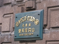
IMG_5580.jpg
Kyoto 9 Nov 2007
Sign on the east side of the entrance to the Nintendo building.
(IMG_5580.JPG)
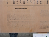
IMG_5589.jpg
Kyoto 9 Nov 2007
Description of a shrine we visited on the walking tour.
(IMG_5589.JPG)
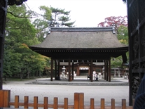
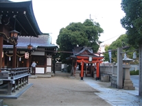
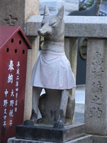
IMG_5592.jpg
Kyoto 9 Nov 2007
This is a Shinto shrine. I have only a vague understanding of the Shinto religion. However, as I understand it, each shrine has a local god (the guide used the word "god" -- I tend to think of the word "spirit," but that might just reflect how firmly I've been indoctrinated in monotheism). Apparently one of the duties of priests is to provide food and drink to the god who resides in the shrine. The tour guide said the objects that look a bit like pillows wrapped in plastic bags in this photos are barrels of sake, which have been donated for the god to drink. I believe that Dennis, Gary, and I saw items like this at a shrine in Kobe, but (at that time) did not know what they were (at least I didn't).
(IMG_5592.JPG)
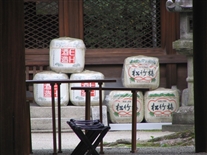
IMG_5593.jpg
Kyoto 9 Nov 2007
This photo is a better view of the sake barrels taken with the zoom lens.
(IMG_5593.JPG)
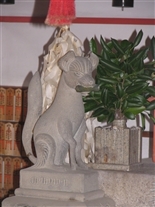
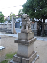
IMG_5594.jpg
Kyoto 9 Nov 2007
Same shirne. I've forgotten the signifigance of the dog -- and of the thing in its mouth, which is probably a bone, but perhaps not. I just don't remember.
(IMG_5594.jpg)
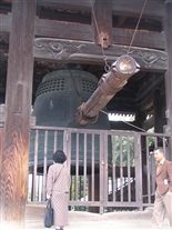
IMG_5596.jpg
Kyoto 9 Nov 2007
This is a large bell protected by a shed. The horizontal thing is a wooden beam which strikes the bell to ring it, swinging like a pendulum.
(IMG_5596.JPG)
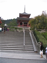
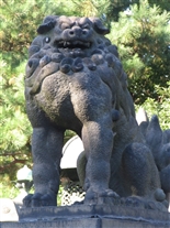
IMG_5603.jpg
Kyoto 9 Nov 2007
The is photo and the next one were taken at a shrine that is, I believe, called Kiyomizudera. It is on the side of the ridge on the eastern side of the city. At the end of the guided walking tour (near the base of the eastern ridge), the tour guide discussed several options for those who wanted to continue the walking tour (without him). I picked the option of going up to this shrine, which was at the top of a series of steep narrow uphill streets (the steps in this photo are perhaps 5% of the total vertical "climb" to reach the shrine). The last couple blocks (immediately prior to these stairs) were on a VERY narrow (and crowded) uphill street, lined on both sides with shops. I understand these shops had already been in the business of overcharging tourists for a few centuries at the time Columbus sailed (visitors were probably called something more like pilgrims back then, rather than tourists).
The guide said that people who chose this tour-extension option would probably see "geishas" on the way to this shrine. However, they aren't real geishas. Apparently, it is very popular, when Japanese couples visit Kyoto, for the woman to have a geisha "makeover" -- hair styling (or perhaps a wig), makeup, kimono, and special shoes (they appeared to be made of wood). I gathered this costs the equivalent of a few hundred $ (minimum; I suspect buying a kimono is like buying a boat -- or a computer -- there is no upper limit). I did indeed see about 8 or these geisha wannabes, each with a husband or boyfriend -- except for two who were walking together. I didn't try to take photos of any of these women. Later, it occurred to me there may be an element of fantasy fulfillment in this -- perhaps for both the husband/boyfriend and the woman. Back when Kyoto was the imperial capitol, it was apparently known for having a large number of geisha schools (and the best ones). Apparently a few of these are still in operation there.
(IMG_5603.JPG)
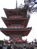
IMG_5605.jpg
Kyoto 9 Nov 2007
Closer view of the pagoda at the top of the stairs shown in the previous photo.
(IMG_5605.JPG)
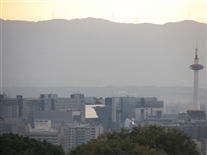
IMG_5610.jpg
Kyoto 9 Nov 2007
This is the view from the hillside shrine, looking back toward the Kyoto Tower. I believe the structure just to the right of the center of this photo -- the structure with a faceted reflective surface -- is part of the ultramodern train station.
(IMG_5610.JPG)
IMG_5611.jpg
Kyoto 9 Nov 2007
This is to show that no matter how exotic a place is, some things are always the same.
(IMG_5611.JPG)
