IMG_0029.jpg
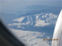
Flying over the European Alps -- 16 Nov 2011
Trip started with drive to Atlanta. Then flew to New York (JFK Airport) on Delta, then to Cairo on EgyptAir, then to Amman Jordan, also on Egypt Air.
The Jordan part of the trip was an extra-$ add-on pre-trip excursion. The six people on this pre-trip met up with one another at the Cairo Airport (in the international passenger transfer area -- we did not really officially "enter" Egypt on that leg of the trip.
This photo was taken out of the airplane window. This is probably someplace over the alps, possibly over Switzerland.
After 5 days in Jordan, we flew back to Egypt, that time entering the country. The photos from the Egypt portion of the trip are in a separate gallery (or possibly two separate galleries).

IMG_2161.jpg
Resort on Shores of Dead Sea -- 17 & 18 Nov 2011
We arrived in Jordan after dark. Hotel was a resort on the east shore of the Dead Sea (near its northeast "corner"). It was a Movenpick resort. That's a hotel chain I'd never heard of before (that I recalled). It's apparently a Swiss company.
We had seem the lights of Jericao and, I believe, Jeruselem while driving to the Dead Sea from the airport. My recollection is that the Amman Airport is about 3000 feet above sea level, while the shore of the Dead Sea is about 1000 feet below sea level.
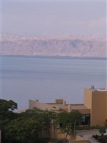
The resort was quite nice. Have many photos of the exterior, but apparently did not take any of the interior of the room.This one, and the three that follow, are looking out toward the Dead Sea in early morning, probably from the room.
Several of the photos in this gallery were "edited" in varous ways (such as by rotating and cropping an image to "level" a horizon (or other type of linear feature that it seemed to me "should" be horizontal. The presence of an "A" or a "B" in the photo ID number is probably a sign that the photo has been rotarted and/or cropped.
In this gallery, the option in the photo editor software called "Touchup: Levels Auto Fix" seemed to do wonders at "cutting thru" haze. I had seldom previously used that program feature (and don't recall any dramatic improvements when I did try it in the past). That feature is used on several photos in this gallery, including this one (in a few places, I included two versions of the same photo in this gallery, one with the Levels "Auto Fixed" and one without that "fix") to enable comparisons. This shot has been "Auto Fixed" (but a comparison shot is not included).
IMG_2174.jpg
Resort on Shores of Dead Sea -- 17 & 18 Nov 2011
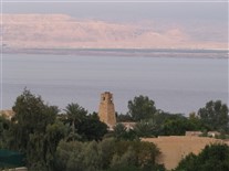
Another shot looking out over the resort. Probalby without the auto fix.
IMG_2175.jpg
Resort on Shores of Dead Sea -- 17 & 18 Nov 2011
Using 10X zoom to get a better view of the far shore, which is Israel here, I'm almost certain.
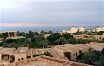
IMG_2132B.jpg
Resort on Shores of Dead Sea -- 17 & 18 Nov 2011
Another view looking out over the resort.
IMG_2138.jpg
Resort on Shores of Dead Sea -- 17 & 18 Nov 2011
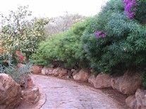
Resort was fairly large. It seemed to have several sections. We were in a hotel, but it also seemed to have sections that seemed to be condos and/or timeshares. There was also a cluster of restaurants.
The areas between the secions were nicely landscaped. There was a probably a 100-150 foot vertical elevation difference between the hotel lobby and the actualy shore of the Dead Sea.
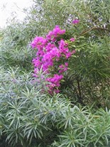
This photo shows some of the landscaping features (as do the next two).
IMG_2147.jpg
Resort on Shores of Dead Sea -- 17 & 18 Nov 2011
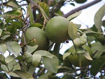
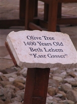
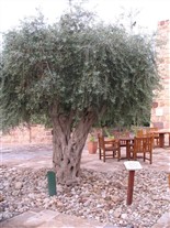
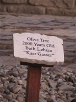
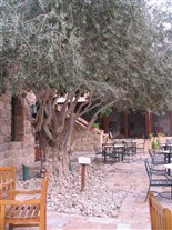
This is the first of four photos that deal with olive trees.
These two ancient olive trees were on a large patio that was the outside seating area of a cluster of restaurants (pehaps 7 of them in all). The trees must have been left standing when the resort was built. I'm a bit skeptical as to how accurate these signs are as to the actual age of these trees.
The restaurants seemed to have inside seating also. These were sit-down restaurants. It was arranged a bit like a food court, but they were not fast food (in either the quality of service or the quality of food).
This "food court" area was perhaps 1/3 of the way "down" from the hotel to the shoreline. There was a breakfast area in the hotel (included with the room for us). There was probably a table service restaurant in the hotel too, but, if so, I do not remember seeing it.
A belly dancer performed on this patio one night. She seemed to be Russian (or perhaps from another country from Eastern Europe). At the time, I figured the nationality of the dancer was a modesty thing -- they didn't a Moslem woman peforming in front of foreginers. However, later it occurred to me that it might also have something to do with the nationality of the guests at the hotel, many of whom seemed to be Russian.
IMG_2156.jpg
Resort on Shores of Dead Sea -- 17 & 18 Nov 2011
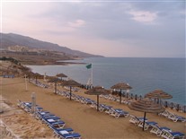
Lower level area of hotel. This is the "near-the-beach" level of the resort.

IMG_0061.jpg
Resort on Shores of Dead Sea -- 17 & 18 Nov 2011
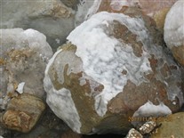
Rocks at the edge of the Dead Sea are encrusted with salt deposits.
IMG_0064A.jpg
Resort on Shores of Dead Sea -- 17 & 18 Nov 2011
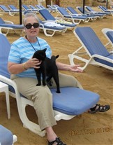
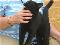
The beach area seemed to have a "watchcat". This was early in the morning, our final morning at this resort, if I recall correctlly.
IMG_0071.jpg
Resort on Shores of Dead Sea -- 17 & 18 Nov 2011
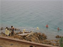
The water level of the Dead Sea has been dropping probably more than one foot per year of over 20 years (probably longer, but I did't see any really long-term numerical data.
The amont of the drop is quite evident in this "near-the-beach" area. You can see how their walls and steps that provide access from the patio containing the beach chairs has been modified at least once. Now they also have this jury-rigged aluminum ramp to provide a walkway over the rocks for people to use to enter the water. It's probably a losing battle.
These people are floating in the water, not standing (you can see that the legs of the woman on the right hand side of the photo are extended horizontally in front of her). The "proper" way to do this is to float in the water in a sitting position, like you are sitting in a chaise lounge. I saw one woman "sitting/floating" like that reading a book (but she may have had the book with her for posing for a photo).
Because of the high salt content of the water, you float VERY high.
Most of the people at the shore at this time (early morning) seemed to be Russian,
L-056.jpg
Resort on Shores of Dead Sea -- 17 & 18 Nov 2011
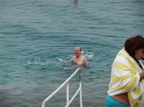
That's me in the water (trying with limited success) to get the hang of the floating/sitting technique.
My body was so bouyant in the high-salt-concentration water that once my feet lost contact with the bottom, I had trouble getting them back down into the water to stand up again.
IMG_2155.jpg
Resort on Shores of Dead Sea -- 17 & 18 Nov 2011
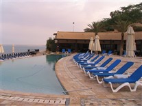
There were two or three pools in the resort. This is the one near the Dead Sea. Can't remember if this was slat water or fresh water.
IMG_2152.jpg
Resort on Shores of Dead Sea -- 17 & 18 Nov 2011
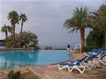
A different pool, closer to the hotel and restaurant area (there was only a snack bar down by the "beach").
IMG_0075.jpg
Resort on Shores of Dead Sea -- 17 & 18 Nov 2011
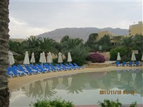
Another view of the pool by the restaurant.
IMG_0058.jpg
Resort on Shores of Dead Sea -- 17 & 18 Nov 2011
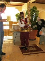
This guy provided drinks (fruit juice) in the hotel lobby. His "belt" is a rack containing plastic cups.
IMG_2186.jpg
Dead Sea Museum -- 17 Nov 2011
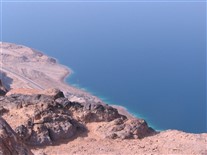
On our way to a museum about the Dead Sea. Museum is at a spot that overlooks the Dead Sea.
IMG_2191.jpg
Dead Sea Museum -- 17 Nov 2011
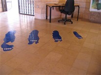
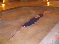
A different type of map of the Dead Sea in the museum.
IMG_2193.jpg
Dead Sea Museum -- 17 Nov 2011
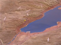
Close up of the map showing the area near the hotel (and perhaps the museum too).

IMG_2208A.jpg
On Way to Bethany -- 17 Nov 2011
Taken from the bus (and uses "Levels: Auto Fix"). Saw lot of scenes like this along roadsides. However they were diffciult ot photograph from a moving bus.
L-014.jpg
Bethany -- 17 Nov 2011
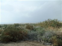
This is in a area called Bethany. It is a Christian site. This is supposed to be the wilderness where John the Baptist lived (and where Jesus lived for 40 days and 40 nights and was tempted by Satan -- I THINK I have the stories straight here). It's not very photogenic. To me this is a "wilderness" more like the moors in England than the "deep woods" area that I think of as a "wilderness" in the US (but, of course, the King James translation WAS by people who lived in England).
L-027.jpg
Bethany -- 17 Nov 2011
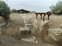
This is the same Bethany area.
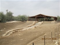
This is said to be the spot where John the Baptist baptized Jesus. It's an area that was once the main branch of the Jordan River. The river channel has moved in 2000 years, it is now perhaps 150-200 yards away.
The river came from the left side of the photo, in the area between the trees at left and the building in the distance. It flowed thru the area where the large square blocks are, then flow off to the left, thru a gully out of this photo, but near the lower left hand corner of the photo. The gully can be seen in a later photo in this set.
The stairs go down to what is supposed to be the actual baptism site. The stairs that exist therenow were built several hundred years after New Testament times.
It looked to me like this river still flows in this channel perhaps a few days each year (possibly after heavy rains or during spring snow melt -- althougth I'm uncertain as to what kind of a snow accumulation the mountains in this region get each year).
This is apparently one of at least three areas in Jordan and Israel where this baptism is said to have taken place.
Pope John Paul II is said to have visited here a few years before I was there. He is supposed to have "blessed" or "recognized" this as the actual site (but I'm pretty sure it was not a proclaimation of the tyoe where he is infalible -- ex cathedra, I think they are called).
The building (large shed) in the distance covers portions of the ruins of some older Christian churches in the area. Exhibits there (and elsewhere around the site) indicated there is archeological and documentary evidence this area has been "accepted" (by some) as the actual baptism site since at least the year 500 (but, of course, that's a long way from having a solid chain of evidence dating back to year 26, or year 30).
L-025.jpg
Bethany -- 17 Nov 2011
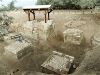
The four squarish block seem to be remians of an older structure that once covered the site -- pehaps a small dome of some type build on arches.
IMG_0031.jpg
Bethany -- 17 Nov 2011
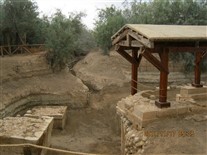
This photo shows how (when this channel is flooded) water seems to flow out of this basin toward what is now the main channel of the river.
IMG_0037.jpg
Bethany -- 17 Nov 2011
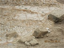
This photo shows a section of the ruins of what had been a mosiac tile floor of a church that once existed on this spot. There were several similar items under or near the large "shed" building. I forget the particulars of this one, but I believe some of these recognizable ruins date from around the year 800.
IMG_0038.jpg
Bethany -- 17 Nov 2011
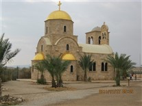
There seemed to be five or six Chrisitan Churches in this area (which the Jordanain government seems to have set off as a preserve or reservation of some kind). This one is Greek Orthodox, I believe. Another one is Catholic (I supect the pope may have been there to consecrate that church). All of the churches seem failry new.
This area is RIGHT on the border with Israel (maybe? -- this is discussed in conjunction with a photo that appears later). It had apparently been a military reservation for many years until some time after Jordan and Israel signed a peace agreement (in the mid-1990s, I think). There were stll a few lighly-armed Jordanian soliders in jeeps parked in a couple locations in the area, but no heavy weapons and no visible active fortifications. In a few places, the ruins of a high barrier fence were visible (looked like the fence had been quite substantial, maybe 15 feet high and topped with razor wire). However, large sections of the fence had been removed to allow roads for tourist access (and the fencing in these locations had been destroyed -- there were no gates).
L-034.jpg
Bethany -- 17 Nov 2011
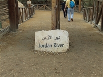
This river access point is probably less than 100 feet from the church in the preceding photo.
IMG_0041.jpg
Bethany -- 17 Nov 2011
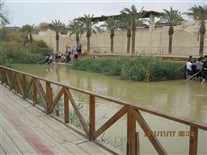
This is the Jordan River. It was surprisingly small -- it would probably be called a creek in Arkansas. But, the water in it was flowing pretty swiftly, and it looked deep. I have no idea if this was the normal flow, or it we were there during a period of high water.
I was standing on a wooden platform that was perhaps 18-24 inches above the water level (and the edge of it may have extended out over the water). I seem to recall there were some wooden steps allowing access down to the water (on the Jordan side of the river) off the right hand side of this photo.
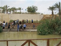
As you can see in this photo, there is a more elaborate area on the opposite side of the river. There were at least two areas here where people (Christian religious groups, I'm sure) could go down to the river easily. The areas were spaced out so groups can services without disturbing each other. The people across the river were close enough so that I could easly have conversed with them (had they not had a service going on).
IMG_0043.jpg
Bethany -- 17 Nov 2011
View of the river access point on the Israel side that was directly across from the Jordan access point by the Greek Orthodox church.
I didn't pay much attention to what they were doing, but the steps seem to be set up for denominaitons who do baptism by immersion.
Next photo is a zoom lens shot of the flags visible in the background.
IMG_0045A.jpg
Bethany -- 17 Nov 2011
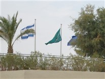
Flags.
One seems to be the Israel flag. I'm not sure what the others are, but neither one looks to me like the flag of the Palestine Authority (based on a internet serach for what the Palestine flag looks like).
Based on maps, I thought the area directly across the river here was a portion of the West Bank controlled by the Palestinian Authority. I was surprised to see the Israel flag. Perhaps, Israel retains control of the borders -- so the Palestinians are sefl-governing only in the internal regions of the West Bank. I haven't tried to research this in any detail.
IMG_0046.jpg
Bethany -- 17 Nov 2011
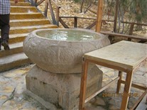
This is almost certainly a baptismal font on the wooden deck adjacent to the river on the Jordan side. I'm guessing it is associated with the orthodox church adjacent to this river access point.
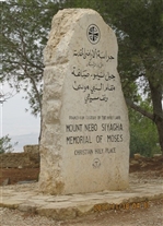
IMG_0088A.jpg
Mt Nebo -- 18 Nov 2011
This was the next day. We checked out of the hotel at the Dead Sea and drove to the modern town adjacent to Petra.
We stopped at a few places on the way. This one is Mount Nebo, where Moses is said to have viewed the promised land, which he did not live to enter.
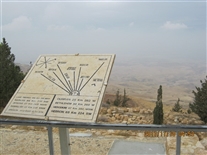
IMG_0092.jpg
Mt Nebo -- 18 Nov 2011
Very hazy here. This sign indicates the things we could see if we could see them.
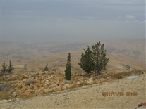
IMG_0095.jpg
Mt Nebo -- 18 Nov 2011
Can't see the Dead Sea, much less anything on the other side of it.
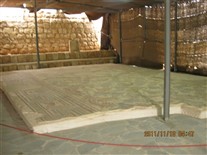
IMG_0091.jpg
Mt Nebo -- 18 Nov 2011
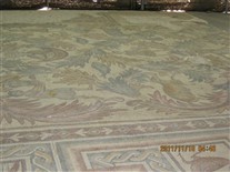
Mount Nebo has 5 peaks. I think there was a church or monastary on each of them. And there have been churches there for a long, long time. This is a section of a mosaic floor that remains from an older chruch that no longer exists (except for scattered ruins). It's covered by a steel roofed shed with tent-like sides.
IMG_0127.jpg
Madaba Jordan -- 17 Nov 2011
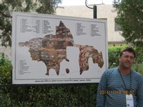
This is a church built over a much older Roman-era church. There are ruins of a mosaic tile floor in the basement of the current church. This is kind of a pre-show exhibit to help guides explain to tourists what they are going to see when they enter the church and do to the basement. The map is an early Christian style where they show Jeruselum as the center of the world.
Only a portion of the original map still exists. Jeruselum is an oval near the lower left portion of the fragment of the map that still exists.
IMG_0127A.jpg
Madaba Jordan -- 17 Nov 2011
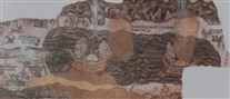
This is cropped from the previous photo. It shows the portion of the map that shows the dead sea. The wooden-tub-like features are boats floating in the Dead Sea (not to scale, of course). The figures of people in the boats have been erased (or obscured -- these are the egg-shaped "objects" "in" the boats). This was apparently done at a time when Moslems used the building, in accordance with Moslem rules about pictorial representations of humans.
Looks like other features (alongside the boats, but not "in" them) have also been partially erased. I'm not sure what was going on there.
IMG_0137A.jpg
Petra Hotel -- 17-19 Nov 2011
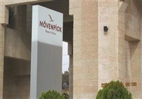
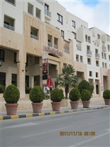
Hotel just outside Petra. We arrived here late on the 17th and checked out early on the 19th.

IMG_0133.jpg
Petra Hotel -- 17-19 Nov 2011
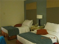
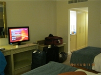
This time, I remembered to photograph room interiors.
IMG_0132.jpg
Petra Hotel -- 17-19 Nov 2011
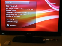
This is what was displayed on that TV screen when I entere the room.

L-104.jpg
Petra (Ancient City) -- 18 Nov 2011
After entering the historical area the next morning, following our after-dark arrival. That's me in the baseball cap.. The couple in this photo were also on the Vantage tour.
IMG_0158A.jpg
Petra (Ancient City) -- 18 Nov 2011
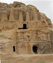
Essentially all of these things were made as tombs. Several have names that suggest other uses, but they were tombs. This one was multi-level.
IMG_0298.jpg
Petra (Ancient City) -- 18 Nov 2011
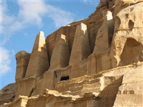
This was taken later in the day, on the way our of the area. It had apparently been overcast in the morning, but the sun was shining by afternoon.
IMG_0168.jpg
Petra (Ancient City) -- 18 Nov 2011
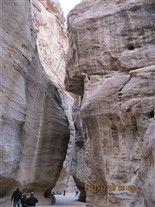
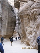
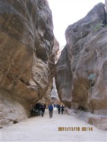
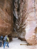
After a time, the trail (road) entereed this narrow canyon.
IMG_0171A.jpg
Petra (Ancient City) -- 18 Nov 2011
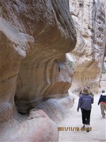
This shows a water transport feature (acquduct?) carved into the side of the wall. I believe these were on both sides of the canyon, although I believe they are no longer intact for the entire length of the canyon. On the other hand, cats lived here -- and they must drink somehow.
IMG_0172A.jpg
Petra (Ancient City) -- 18 Nov 2011
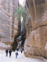
Notice a tree growing up on the canyon wall here. There were several like that.
IMG_0179A.jpg
Petra (Ancient City) -- 18 Nov 2011
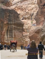
There were several modes of transport for people who did want to walk (or were unable too -- I believe it was 4 miles in downhill) and them 4 miles out (uphill). The transport SEEMED to be "zoned," with horses in one area, carriages in another, camels in another, and donkeys in yet another. This could have been to make people who wanted to use transport all the way pay multiple fees -- but that's speculation, I'm not sure about it.
IMG_0192.jpg
Petra (Ancient City) -- 18 Nov 2011
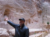
I think he is explaining there were once shirnes or memorials in these alcoves.
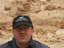
IMG_0163.jpg
Petra (Ancient City) -- 18 Nov 2011
Close-up so you can read the great emblem on his cap.


IMG_0194.jpg
Petra (Ancient City) -- 18 Nov 2011
There had once been a carving on the canyon wall of a caravan of people and camels. This is one of the few parts of it that survive.
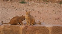
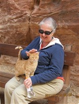
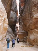
IMG_0196.jpg
Petra (Ancient City) -- 18 Nov 2011
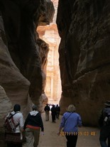
Near the end of the canyon now. You can see a bit of the "Treasury" in the distance at the end of the canyon.
That's some of the Vantage people in this shot.

L-134.jpg
Petra (Ancient City) -- 18 Nov 2011
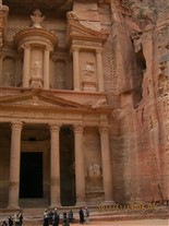
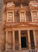
It's called the Treasury, but it's a tomb.
This is the most famous one. It "starred" in the third Indiana Jones movie.
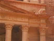
The next several photos show various details.
IMG_0205A.jpg
Petra (Ancient City) -- 18 Nov 2011
Note the parallel "ladder" of holes at left. There are similar holes on the other side. I'm not sure if they think these were used during construction or were made later.

IMG_0208A.jpg
Petra (Ancient City) -- 18 Nov 2011
This is a photo where I used the auto fix software option. It seems to have increased clarity and details, but washed out the color.

IMG_0203A.jpg
Petra (Ancient City) -- 18 Nov 2011
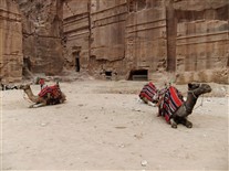
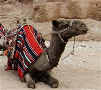
There were camels for rent in this Treasury area.

IMG_0215.jpg
Petra (Ancient City) -- 18 Nov 2011
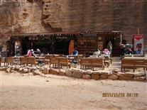
There were little shops and food stands in several areas. As I understood it, several groups of Bedouins used to live here. To develop this as a tourist area, they made them move (into a nearby community built for them). However, several of the families retained the right to operate various concessions during daylinght hours, such as these food stands, gift shops, and (I imagine) the horse, carriage, donkey, and camel transport concessions.
IMG_0228.jpg
Petra (Ancient City) -- 18 Nov 2011
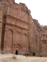
After you get past the treasury, the canyon gets considerably wider.

IMG_0232A.jpg
Petra (Ancient City) -- 18 Nov 2011
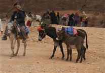
Now we seemed to move into the donkey transport concession area.
IMG_0235A.jpg
Petra (Ancient City) -- 18 Nov 2011
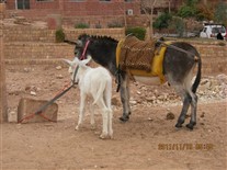
A few donkeys seemed to have their babies (colts?) with them. Unless we happened to be there during take your baby donkey to work day.


IMG_0248A.jpg
Petra (Ancient City) -- 18 Nov 2011
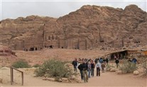
Here you can see how the canyon opens up. The area in the background might be called the castle (or something like that). Note the little concesson shop at right.


IMG_0262.jpg
Petra (Ancient City) -- 18 Nov 2011
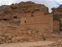
Now we are entering an area that used to be a trading center in camel caravan days. The drawing is intended to provide some ideaof what it used to look like.


IMG_0279.jpg
Petra (Ancient City) -- 18 Nov 2011
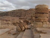
Note the collapsed columns. Looks like a fallen stack of poker chips.

IMG_0282.jpg
Petra (Ancient City) -- 18 Nov 2011
Here I was up inside the ruins of an old temple.

IMG_0283A.jpg
Petra (Ancient City) -- 18 Nov 2011
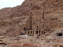
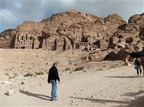
The people at lower left (who are in the foregraound) give some idea of the scale of this place.

IMG_0285.jpg
Petra (Ancient City) -- 18 Nov 2011
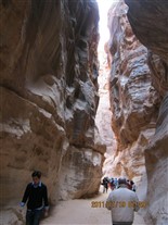
Now I've started back, going thru the narrow canyon -- uphill all the way going back.


IMG_0287.jpg
Petra (Ancient City) -- 18 Nov 2011
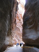
The flat rocks on the ground are remains of the original Roman road thru this canyon. Later (May 2016): actually, thinking about this more, it's possible that the Roman road may not have been "original". It may have been the Romans' improved version of an even older road thru this canyon.
IMG_0303.jpg
Petra (Ancient City) -- 18 Nov 2011
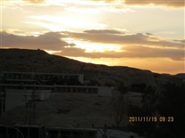
Sunset, over the mountain, I think. (IMG_0303.jpg)
IMG_0308.jpg
Ammon Jordan -- 19 Nov 2011
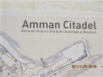
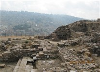
This is the next day. We drove to Amman. After a drive-thru tour of parts of the city, we went to the Citadel in the original center of town -- an ancient fortress. This hilltop citadel is said to be the place where the biblical King David sent Bathsheba's husband to be killed in a war against the Ammonites (Amman -- Ammonites, get it?).
IMG_0313A.jpg
Ammon Jordan -- 19 Nov 2011
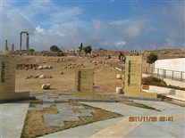
Looking across some of the ruins. The modern city is in the background. Actually, for this central point in the old city, the modern city is in the background no matter which direction you look.
IMG_0318.jpg
Ammon Jordan -- 19 Nov 2011
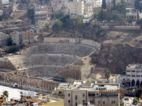
Looking down from the citadel. There is what appears to be an ancient Roman ampitheater dug into the base of the next hill.
IMG_0323.jpg
Ammon Jordan -- 19 Nov 2011
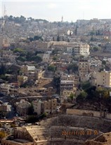
This is the ampitheater shown in portrait format to give some idea how tall that next hill is.


IMG_0362.jpg
Ammon Jordan -- 19 Nov 2011
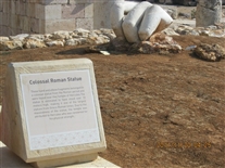
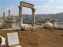
Looks like part of the hand of the stature remains. The other piece might be a knee (maybe?).

IMG_0363A.jpg
Ammon Jordan -- 19 Nov 2011
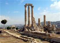
This photo and the next one illustrate the effect of the Levels: Auto Fix. This one does not have the Levels: Auto Fix.
IMG_0331.jpg
Ammon Jordan -- 19 Nov 2011
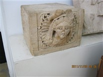
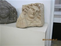
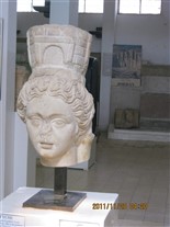
This is the first of five photos that show selected items inside the museum.

IMG_0342.jpg
Ammon Jordan -- 19 Nov 2011
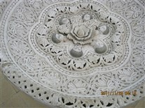
The next photo shows a detail of the inside of this basin.

IMG_0365.jpg
Ammon Jordan -- 19 Nov 2011
Many years ago, I read a novel called "The Ugly American" (later made into a Marlon Brando movie). The novel described an episode where the US government gave aid to a country (food, if I recall correctly), but (thru bureaucracy in inaction) ensured the people of the recipient country did not know the aid was from the people of the United States. I was reminded of the episode in that book when I saw this sign -- in English -- in a public park in a primarily-Arabic-speaking country.

IMG_0370A.jpg
Ammon Jordan -- 19 Nov 2011
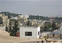
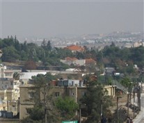
My understanding is that the royal palace is the red-roofed building in the wooded area in the distance. Next photo is a cropped version that tries to enlarge it.
IMG_0370B.jpg
Ammon Jordan -- 19 Nov 2011
My understanding is that the palace is the red-roofed building just above the center of thsi photo.
IMG_0372.jpg
Ammon Jordan -- 19 Nov 2011
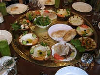
This is the lunch we had this day. They serve sort of a combination of tapas and family style.

IMG_0375.jpg
Ammon Jordan -- 19 Nov 2011
A tea service and a sculpture in the restaurant where we had lunch.
IMG_0381.jpg
Jerash Jordan -- 19 Nov 2011
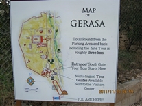
The modern name for the city is Jerash. Gerasa was the name of the ancient Greco-Roman city. It is not exactly lost (like Pompeii) but it was destroyed by an earthquake in 749 and never rebuilt (except perhaps that a couple small villages occupied and some military fortifications occupied the site at times. The center of the ancient city was apparently never completely built over (altthough parts of outlying areas were built over as the modern city of Jerash was developed in the 1900s).
Given a major earthquake and over 1000 years of neglect, it seems pretty clear that much of what is standing there today has had some degree of reconstruction. In some places (such as the ampitheater and Hadrian's Gate) the reconstrution is good. In others (such as a wall alongside the hippodrome) it seemed haphazard. I spotted (but apparently did not photograph) a retaining wall made out of stone blocks. Some blocks had shapes and portions o words engraved on them. However, there clearly had been no effort to match up stones. I saw some inscribed stones placed with letters upside down and not near any similarly enscribed stones.
Excavations started in the early 1800s and the modern city began to develop after those excavaitons started.
Later (May 2016) -- This was probably just as impressive as Petra, but is apparently not nearly as well known.

IMG_0382.jpg
Jerash Jordan -- 19 Nov 2011
Hadrian's gate. Commorates a visit to the city by the Roman emperor around the year 139.

IMG_0396.jpg
Jerash Jordan -- 19 Nov 2011
Circular colonade at apparenltly the center of the city.
IMG_0409.jpg
Jerash Jordan -- 19 Nov 2011
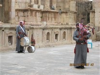
Inside the ampitheater. These are retired Jordanian Army musicians who play here.
Note the bagpipes. The Jordanian army apparently still "remembers" their orign under British training in during the time under the mandae of (I'm guessing) the League of Nations between World Wars I and II.

IMG_0416.jpg
Jerash Jordan -- 19 Nov 2011
On the hiltop. From the left: ampitheater, Hadrian's Gate in the distance, then part of the modern city in the distance, then the regular (ancient) city gate in background and circular colonade in foreground.

IMG_0418.jpg
Jerash Jordan -- 19 Nov 2011
Looking downhill. I'm looking down a street (and it seemed to be a side street). We will come back to this street later.

IMG_0430.jpg
Jerash Jordan -- 19 Nov 2011
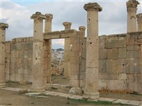
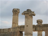
This is a temple, later converted to a Christian Church (I'n not sure if it was also a mosque at one time). The next two photos are other views of these columns.

IMG_0436A.jpg
Jerash Jordan -- 19 Nov 2011
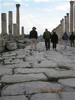
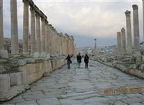
This is after we have reached the end of the hilltop path, come downhill, and now were going back toward Hadrian's Gate. Here we are walking on the ancient pavement on what was apparently the main street. I seem to recall there were chariot or wagon ruts in the pavement, but I can't see any in this photo.

IMG_0440A.jpg
Jerash Jordan -- 19 Nov 2011
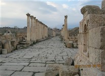
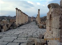
This is looking back uphill. This is the same side street we that we looked down earlier (when we were on the hilltop).
Not Levels Auto FIx here. The next photo is this same view (and the same starting image) but with Levels Auto Fix actuated.
IMG_0440B.jpg
Jerash Jordan -- 19 Nov 2011
Stayed here during last night in Jordan before flying to Cairo the next morning. (IMG_0440B.jpg)

IMG_0446.jpg
Hotel in Amman Jordan -- Night of 19/20 Nov 2011
This is the hotel where we stayed in Amman for our last nigh in Jordan. We had a flight to Cairo the next morning.
IMG_0442A.jpg
Hotel in Amman Jordan -- Night of 19/20 Nov 2011
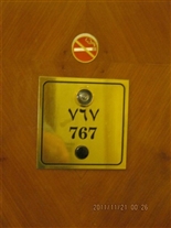
The hotel room numbers were on the room doors twice -- in two sets of numerals: (1) the "standard set" (standard to us), which, in my experience, we call Arabic numerals, and (2) the set that is apparently more traditionally used in Arabic countries (which I believe I heard referred to as Indian numerals). The full set is of these numerals is listed in the section describing this trip in the Writing section of this web site.
